Red Cross in imagery data recording
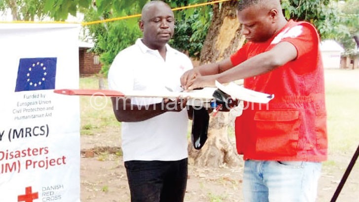
Malawi Red Cross Society (MRCS) under European Union Civil Protection and Humanitarian Aid has embarked on recording data using a drone to establish a hazardous map for disaster early warning in Karonga.
MRCS data team leader Gumbi Gumbi made the remarks on Monday in Traditional Authority (T/A) Mwirang’ombe in the district during the launch of the exercise. The mapping exercise will take place in T/As Kilupula, Mwirang’ombe and Mwakaboko.

drone ready for action
“By coming up with imagery data, we want to know what causes disasters such as floods and the number of people likely to be affected when such disasters occur,” he said.
Gumbi said the imagery data will, among other things, assist MRCS and other stakeholders to educate people on the type of houses they are should build in the area.
In his remarks, Karonga District acting disaster officer Victor Phiri commended MRCS for the initiative. “You will agree with me that some areas in the district and the country in general have been experiencing disasters that they never experienced before,” he said.


