Using an innovative, 21st-century way to destroy a centuries-old problem, scientists at the Malawi Liverpool Wellcome Trust use drones to map out where mosquitoes breed in an effort to identify and destroy malaria-causing mosquitoes.
In Malawi, malaria is one of the top three public health issues, according to a study published in the Malaria Journal.
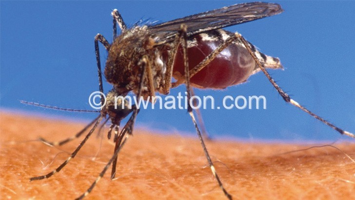
Nearly four million people are diagnosed with the infection every year and the country accounts for two percent of malaria cases worldwide.
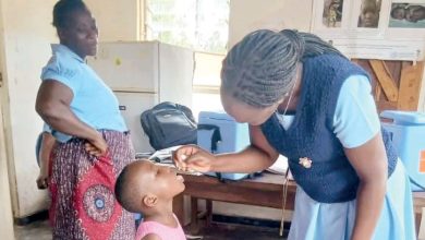
Although the country has made significant steps in controlling the disease by distributing treated mosquito nets and indoor residual spraying, scientists have been looking at ways of modifying potential mosquito breeding sites so that the mosquitos can no longer develop.
When residents of Chiponde Village in Kasungu first saw the small flying vehicles, they were scared, says Symon Moroko, a 41-year-old father of three. Many had never seen a drone before.
But they were reassured when the researchers told them that they were trying to find ways of dealing with malaria, and had picked his village to try out the study.
Most residents are farmers in Chiponde, a typical Malawian village—they rely on selling what they produce.
But the area is also one of the places with a high prevalence of malaria due to the presence of dams and water bodies, providing the mosquitoes with an ideal environment for breeding.
“We see the research as very important to us because many people in this area suffer from malaria,” says Moroko.
“We think this is something that will help in reducing malaria. During the rainy season, most suffer from malaria multiple times.”
He added that last year he had been diagnosed with malaria four times.
This becomes a challenge not only as those who have been infected have to take the 10-kilometre journey either on foot or on bicycles, but they also lose time they could have used to take care of their crops.
In the study published last year the researchers used drones with cameras pointing downwards to capture the photographs of the environment.
They then used the photographs to identify water bodies which are likely to be breeding sites.
“We were then able to use these photographs combined with GPS technology within smartphones and to locate these water bodies and conduct a mosquito larval sampling exercise,” says Michelle Stanton, the study lead.
These photographs gave the researchers a way to track what type of water bodies are ideal for Anopheles mosquito breeding, as well as where to target their eradication campaign.
Although the researchers are still in the process of writing up their report, the project has improved the understanding of how small dams affect mosquito populations.
They have also been able to track how proximity to dams increase the chances of being exposed to mosquitos.
The report will be given to Malawi’s National Malaria Control Programme, hoping it will help the government plan future malaria control activities, like larval source management deployment, bed net distribution, and indoor residual spraying with insecticides.